Last Updated: May 10, 2026
Key Takeaways (TL;DR)
- Why Go: Las Vegas is more than the Strip. Within a two-hour drive, you have five national parks, a canyon carved over five million years, and some of the most dramatic desert scenery in North America. The city itself runs 24 hours and delivers on every type of trip: nightlife, dining, shows, or a quiet base for desert exploration.
- Top Places to Visit in Las Vegas 2026: The Strip, Fremont Street, Red Rock Canyon, Valley of Fire, the Grand Canyon South Rim, Hoover Dam, Zion National Park, Bryce Canyon, Death Valley, and Sedona.
- Don’t Miss Experience: Watching the sun drop behind the sandstone formations at Red Rock Canyon from the scenic loop road as the rock turns deep copper, then burgundy, and the Las Vegas skyline glitters into view behind you as the desert goes dark.
- Ideal Trip Length: 7 to 14 days. Three to four days covers the city; add four to ten more for the surrounding parks and canyons via RV rental.
- How to Choose the Right Area: Stay on the Strip for shows, casinos, and nightlife. Head to Fremont Street for a grittier, more local Vegas. Drive 30 minutes in any direction for some of the best desert scenery in the American Southwest.
- Recommended Budget Per Person: $80 to $200 per day, excluding RV rental. The range is wide; Vegas has free street spectacles and $600 tasting menus at the same address.
- Watch Out For: Summer heat between June and September is extreme, regularly above 40°C. Plan outdoor activities before 10 AM or after 5 PM. Park entry reservation systems at Zion and the Grand Canyon require advance booking in peak season.
- Where To Stay: An RV rental in Las Vegas lets you drive into the parks at dawn and return to the city at night, or sleep under the stars at a canyon campsite without rebooking accommodation every time your plans shift.
- Best For: Road trippers who want a city base with strong day-trip range, couples, first-timers to the American Southwest, and outdoor enthusiasts.
Table of Contents
- Top Places to Visit in Las Vegas in 2026: at a Glance
- Best Places to Visit in Las Vegas
- What to Pack for a Las Vegas Road Trip
- Final Expert Tips for Las Vegas Travel
- Explore Las Vegas with Indie Campers
- Everything You Need to Know: Las Vegas RV Road Trips
- FAQs About Where to Go in Las Vegas
Top Places to Visit in Las Vegas in 2026: at a Glance
| City/Area | State | Vibe | Best For | Top Activities | Avg Temp | Ideal Stay | Crowd Level | RV-Friendly |
| The Strip | Nevada | Electric and Glamorous | Nightlife, shows | Casinos, dining, entertainment | 37°C (98°F) | 3 to 4 Days | Very High | Limited |
| Fremont Street | Nevada | Retro and Local | Budget travelers, history | Light shows, vintage casinos, bars | 37°C (98°F) | 1 to 2 Days | High | Limited |
| Red Rock Canyon | Nevada | Scenic and Wild | Hikers, photographers | Scenic loop, climbing, sunrise | 30°C (86°F) | 1 to 2 Days | Moderate | Yes |
| Valley of Fire | Nevada | Otherworldly | Photographers, nature | Fire Wave, petroglyphs, hikes | 38°C (100°F) | 1 to 2 Days | Low | Yes |
| Grand Canyon South Rim | Arizona | Iconic and Vast | First-timers, families | Rim Trail, Mather Point, mule rides | 28°C (82°F) | 2 to 3 Days | Very High | Yes |
| Hoover Dam | Nevada/Arizona | Historic and Dramatic | History buffs, families | Dam tour, powerplant, Lake Mead | 36°C (97°F) | Half Day | Moderate | Limited |
| Zion National Park | Utah | Towering and Scenic | Hikers, adventure | Angels Landing, The Narrows, canyons | 33°C (91°F) | 2 to 3 Days | High | Yes |
| Bryce Canyon | Utah | Surreal and Quiet | Photographers, hikers | Sunrise Point, Navajo Loop, stargazing | 22°C (72°F) | 1 to 2 Days | Moderate | Yes |
| Death Valley | California | Extreme and Vast | Nature, photographers | Mesquite Dunes, Badwater Basin, Zabriskie Point | 42°C (108°F) | 1 to 2 Days | Low | Yes |
| Sedona | Arizona | Red Rock and Spiritual | Couples, hikers | Cathedral Rock, Tlaquepaque, jeep tours | 30°C (86°F) | 2 to 3 Days | Moderate | Yes |
Best Places to Visit in Las Vegas
1. The Las Vegas Strip, Nevada
The Vibe
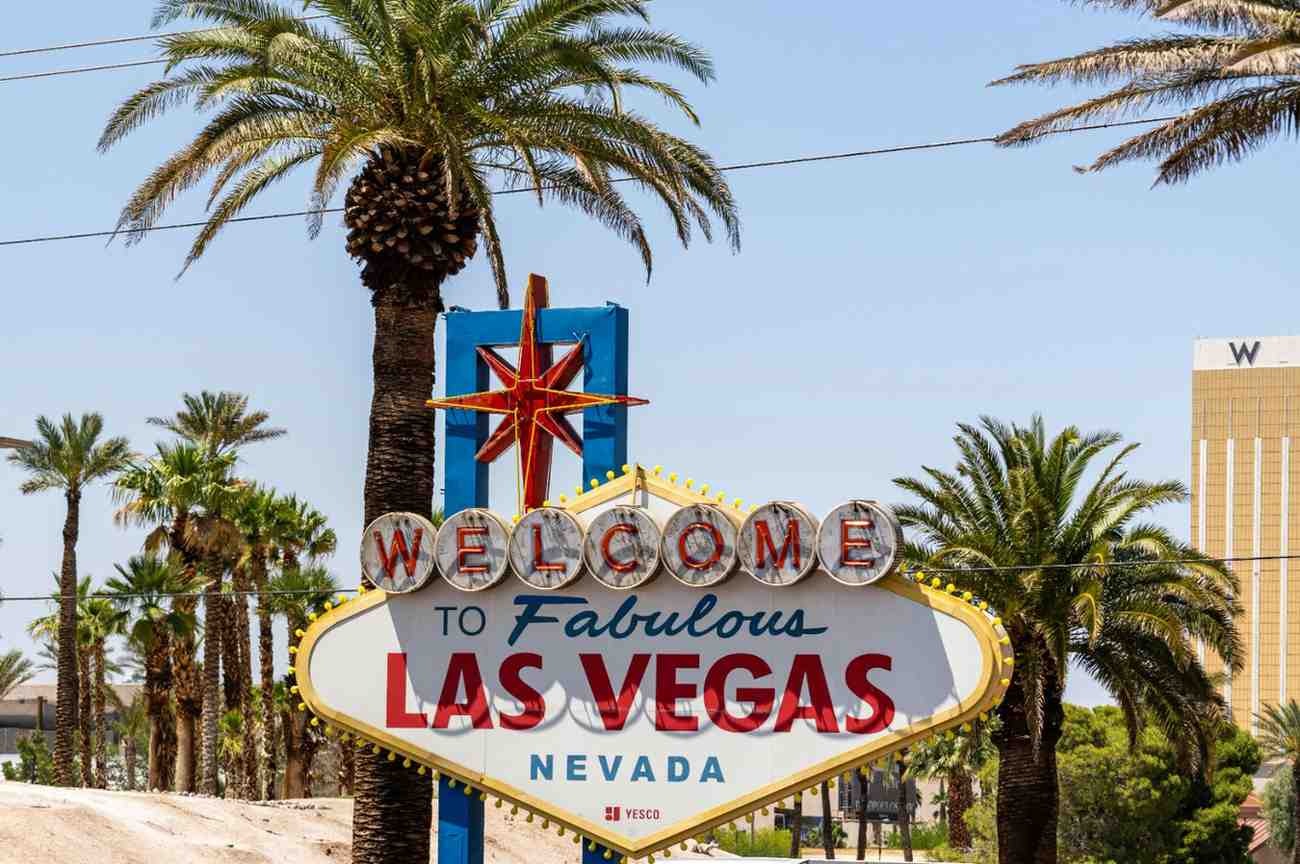
The Strip is a 6.8 km stretch of Las Vegas Boulevard that has no real parallel anywhere else in the United States. It is loud, relentless, and deliberately engineered to make you lose track of time; there are no clocks inside casinos, the light never changes indoors, and the architecture is an intentional blur of replicated Paris, Venice, and ancient Egypt within a single block. The Strip is the best place to visit in Las Vegas if you want the full spectacle of the city in one walkable corridor.
None of that makes it uninteresting. The Strip is a genuine feat of American maximalism. The Bellagio’s fountains are choreographed to opera and run every 15 minutes until midnight. The Sphere, a 17,500-capacity venue wrapped in the world’s largest LED screen, has fundamentally changed what a live event can look like.
Las Vegas was founded as a railroad town in 1905 and transformed by legalized gambling in 1931. The casino era built the city, and mobster money built the casinos; the Rat Pack performed at the Sands in the 1960s for a reason. What remains today is a city that has been rebuilding its own mythology every decade since.
The culture is built around the idea that anything goes and nothing needs explaining. The Strip draws roughly 42 million visitors per year, making it one of the most visited corridors on earth, and yet it manages to feel personal because everyone there is there for their own version of the same thing: permission.
Top Things to Do
1. Walk the Strip After Dark: The full experience of the Strip is a nocturnal one. Walk from the Welcome to Las Vegas sign at the south end to the Wynn at the north, roughly 90 minutes at a casual pace, and stop at the Bellagio fountains, the LINQ High Roller (the tallest observation wheel in the Western Hemisphere), and the main casino hotel facades. The lighting alone is worth the walk.
2. See a Show at the Sphere: The MSG Sphere opened in 2023 and seats up to 17,500 people inside a building covered in 580,000 square feet of programmable LED display. The internal screen wraps the entire interior at a resolution that makes standard arenas feel obsolete. Touring acts and residencies use the venue differently than any previous format. Check the schedule and book well ahead; this is genuinely unlike any show venue on earth.
3. Eat Well: The Strip concentrates more celebrity-chef restaurants per square mile than anywhere outside of New York or Tokyo. Joel Robuchon’s restaurant at the MGM Grand holds multiple stars, and José Andrés, Gordon Ramsay, and Nobu all operate flagships here. For something less formal, the Wicked Spoon buffet at the Cosmopolitan and the Eggslut counter at the Cosmopolitan food court are genuinely excellent.
4. The Bellagio Conservatory and Botanical Garden: A free, year-round attraction inside the Bellagio that most visitors overlook. The conservatory is redesigned five times a year with large-scale floral and sculptural installations; thousands of plants and handmade elements are assembled by a team of 120 horticulturalists. The scale is absurd in the best way.
5. Visit the Neon Museum: A 2-acre outdoor gallery of restored neon signs from the city’s casino and motel history, including the Stardust, the Sands, and the Moulin Rouge. The “Boneyard” night tour uses projection mapping to animate the old signs against the desert sky. It’s a more honest history of Las Vegas than anything on the Strip itself.
Don’t Leave Without…
Watching the Bellagio fountains to a full Celine Dion or Andrea Bocelli set at 11 PM on a weekend, when the crowd around the lake is four people deep and the water goes 150 feet into the desert air. It costs nothing and feels completely out of scale, which is the point.
RV Practical Info
- Parking: RV parking on the Strip itself is limited and expensive. Most major casinos have parking structures, but height and size restrictions vary. The Rio and Palace Station off-Strip both have larger vehicle accommodation.
- Best RV base: North Las Vegas KOA and Las Vegas Motorcoach Resort near the Strip offer full hookups within 15 to 20 minutes of the main attractions.
- City driving: Avoid Las Vegas Boulevard by RV during peak evening hours (8 PM to 2 AM). Use Koval Lane or Paradise Road as parallel routes.
- Scenic drive: The Red Rock Canyon Scenic Loop is 30 minutes west, a one-way 21 km road through some of the most dramatic sandstone country in Nevada.
Who Is It Best For?
- First-time visitors to Las Vegas who want to experience the full spectacle
- Couples looking for dining, shows, and nightlife in one compact area
- Road trippers using Vegas as a city hub between national park drives
- Anyone who has written off Las Vegas and wants to find out what they’ve been missing
Recommended Budget
- Accommodation (campsite): $35 to $65 per night at nearby RV parks with hookups
- Meals: $15 to $30 casual; $80 to $200 or more at fine dining
- Activities: Sphere tickets from $75; Neon Museum tours around $25; most casino attractions free
- Daily estimate: $80 to $200 per person, excluding RV rental. Vegas’s range is wide; you can spend $20 or $2,000 in the same building.
2. Fremont Street Experience, Nevada
The Vibe
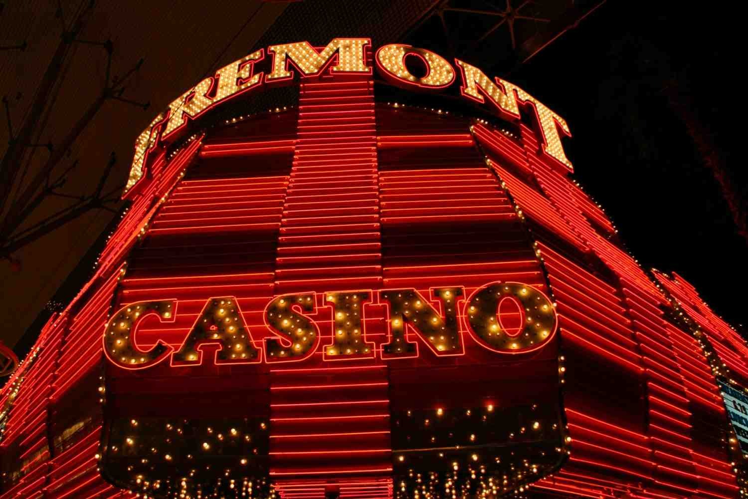
Fremont Street is where Las Vegas started. The first paved street in Nevada, the site of the city’s first casino (the Golden Gate, 1906), and home to the neon signs that defined the early casino era, this is the original Vegas; the version that existed before the megaresorts arrived on the Strip.
Today it operates as an outdoor pedestrian mall under a 460-meter LED canopy, the Fremont Street Experience, which runs free light shows on the hour after dark. The casinos here are smaller, older, and cheaper. The Four Queens, Golden Nugget, and El Cortez have a functional, no-frills character that long-time Vegas visitors find more honest than the theatrical excess of the Strip.
Downtown Fremont is also the center of Las Vegas’s emerging arts district. The 18b Arts District a few blocks south has galleries, independent restaurants, and a monthly First Friday street festival that draws a genuinely local crowd. The Mob Museum, officially the National Museum of Organized Crime and Law Enforcement, covers the real history of how Las Vegas was built and is one of the most professionally curated institutions in Nevada.
The character here is grittier, cheaper, and more interesting to anyone who wants Las Vegas without the performance.
Top Things to Do
1. The Fremont Street Experience Light Show: The 460-meter, $32 million LED canopy runs free shows on the hour from dusk until 2 AM. They run the full length of the pedestrian mall and are best viewed lying on the ground with your head tilted back. The resolution is genuinely impressive, and live music stages run beneath it simultaneously most nights.
2. The Mob Museum: Three floors inside the former federal courthouse where the 1950 Kefauver hearings, America’s first televised organized crime trials, were held. The collection covers the rise of the American Mafia from Prohibition through the casino era, with original FBI evidence, wire recordings, and courtroom recreations. One of the best small museums in the American West.
3. El Cortez: The Oldest Operating Casino: Built in 1941, the El Cortez has not been modernized into homogeneity. Penny slots still exist here. The staff have decades in the building. The Parlour Bar still serves cheap drinks without theater, and it’s the clearest window into what casino culture was before it became a brand.
4. Explore the 18b Arts District: The Arts District runs along Casino Center Boulevard between Fremont and Charleston. Independent galleries, tattoo studios, vintage shops, and restaurants like Esther’s Kitchen, one of the best Italian restaurants in Nevada, make this the most genuinely neighborhood-feeling part of Las Vegas. The First Friday festival (monthly) brings food trucks, live music, and street art to the area.
5. Container Park: An outdoor shopping and entertainment complex made from shipping containers, with a live stage, independent food vendors, and a treehouse play structure for families. Best visited in the evening when temperatures drop and the bar scene activates.
Don’t Leave Without…
A late-night walk through the Golden Nugget to see the 27-pound gold nugget (the Hand of Faith, the largest nugget found by metal detector in history) and the shark tank that runs through the middle of the pool. These two things coexist in one building, which is a fair summary of Fremont Street.
RV Practical Info
- Parking: Municipal RV parking is limited around Fremont. The Fremont Hotel has an attached garage with some height clearance, but call ahead. Park at your campsite and take the Deuce bus down Las Vegas Boulevard.
- Deuce Bus: The Las Vegas Deuce bus runs 24 hours along Las Vegas Boulevard from Downtown to the South Strip. A $6 day pass covers unlimited rides and is the practical way to move between Fremont and the Strip without driving.
- Distance from Strip: About 5 km north, 10 minutes by car and 25 minutes by bus.
- Nearby scenic drive: Lake Mead National Recreation Area is 30 minutes east along the Boulder Highway.
Who Is It Best For?
- Budget travelers who want Las Vegas without Strip prices
- History and culture enthusiasts interested in the city’s real origins
- Solo travelers who prefer a more human-scale environment
- Road trippers staying one or two nights before heading into the parks
Recommended Budget
- Meals: $10 to $25; Fremont’s restaurants and casino buffets are significantly cheaper than the Strip
- Activities: Mob Museum around $20; Fremont Experience free; El Cortez free entry
- Daily estimate: $50 to $100 per person, the most budget-friendly part of Las Vegas
3. Red Rock Canyon National Conservation Area, Nevada
The Vibe
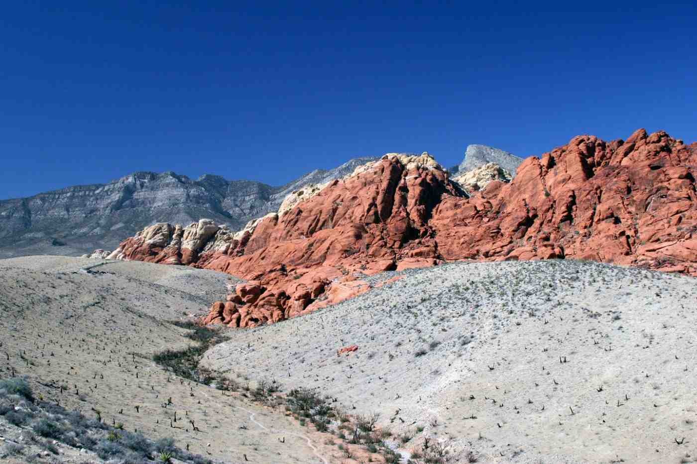
Thirty minutes west of the Strip, the landscape changes entirely. The Las Vegas Valley ends at a red sandstone escarpment, the Calico Hills, that rises 900 meters above the desert floor. Red Rock Canyon is not a national park in the formal sense, but it protects 100,000 acres of Mojave Desert terrain and contains some of the best rock climbing and hiking scenery in the American Southwest. It is one of the best places to visit in Las Vegas for anyone who wants to step outside the city without losing a full day to driving.
The canyon was formed by the Keystone Thrust fault, which pushed older gray limestone up and over younger red Aztec sandstone; that geological collision created the distinctive layered cliffs visible throughout the area. The Calico Hills section, closest to the entrance, produces the most vivid reds at sunrise and sunset when the low light catches the iron oxide in the rock.
The area has cultural significance for the Southern Paiute people, who used the springs at Red Spring and Willow Spring for centuries. Petroglyphs carved into the rock are still visible in several locations.
What makes Red Rock so unusual is the contrast – you get outstanding desert scenery with the Las Vegas skyline visible in the background. You can have brunch on the Strip and be standing at the base of a 300-meter sandstone wall by noon.
Top Things to Do
1. Drive the Scenic Loop: The 21 km one-way scenic loop is the backbone of a Red Rock visit. It passes the major viewpoints, including Calico Hills overlooks, Sandstone Quarry, and High Point Overlook, and provides trailhead access throughout. Arrive before 9 AM to beat heat and crowds. The loop closes at 8 PM (or one hour before dark), and timed entry reservations are required from late winter through fall.
2. Hike Calico Tanks Trail: A 2.2-mile round trip to a natural water tank (tinaja) in a sandstone bowl, with views of the Strip framed by red rock cliffs at the end. The sandstone scrambling in the final section requires comfortable shoes. The contrast between the canyon walls and the distant city is visually striking; it’s one of the best payoff-to-effort hikes in the Las Vegas area.
3. Rock Climbing: Red Rock has over 2,000 documented climbing routes across all grades, from beginner single-pitch routes on the Calico Hills to multi-day big wall climbs on Juniper Peak. The sandstone grips well in cooler temperatures. Las Vegas-based guide companies run half-day and full-day instruction for beginners.
4. Hike Ice Box Canyon: A 2.6-mile out-and-back trail through a narrow canyon that retains cool air from the rock walls. After winter rains, seasonal waterfalls drop into the canyon. It runs several degrees cooler than the surrounding desert even in summer. Best done in the morning.
5. Watch Sunrise from Calico Hills Overlook: Arrive at the first Calico Hills pullout before the loop gate opens and wait. The eastern light hits the Calico Hills across the valley first, then swings around to the main escarpment behind you. The rocks shift from ochre to deep orange to crimson over about 20 minutes, and the Las Vegas skyline is lit up in the west the entire time.
Don’t Leave Without…
Stopping at the Springs Preserve on the way back into the city, a botanical garden and museum on the site of the original Las Vegas springs that made the valley habitable. The desert garden section shows exactly what the Mojave looked like before the city arrived.
RV Practical Info
- Timed entry reservations: Required February through October. Book through recreation.gov well in advance; slots fill weeks ahead in spring.
- Campsite: Red Rock Canyon Campground has 71 sites with no hookups at $15 per night. Water is available but there is no dump station, so plan accordingly.
- Loop restrictions: The scenic loop is one-way and open to all vehicle sizes. No length restrictions, but the turns require careful navigation in larger motorhomes.
- Heat: From May through September, plan all hiking before 9 AM. Carry at least 2 liters of water per person per hour of hiking.
- Scenic route: Continue on SR-159 south from the loop exit to Blue Diamond, then return via SR-160 through Mountain Springs for a complete desert circuit.
Who Is It Best For?
- Hikers and rock climbers who want access to strong terrain within 30 minutes of Las Vegas
- Photographers looking for desert light at golden hour
- Families with active children who need time outdoors between city days
- Road trippers adding a scenic stop before driving to Zion or the Grand Canyon
Recommended Budget
- Park entry: $20 per vehicle (7 days); America the Beautiful Pass applies
- Campsite: $15 per night (no hookups)
- Guided climbing: $120 to $200 for a half-day with a guide
- Daily estimate: $25 to $60 per person, one of the most affordable outdoor experiences near Las Vegas
4. Valley of Fire State Park, Nevada
The Vibe
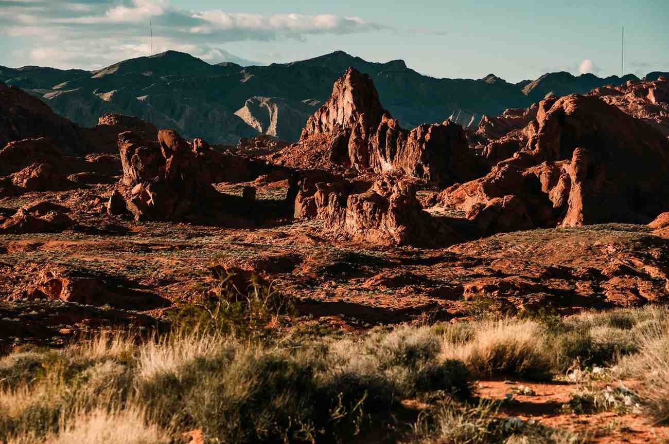
Fifty miles northeast of Las Vegas, the Valley of Fire looks like another planet. The park takes its name from the red Aztec sandstone formations that appear to glow when the sun hits them: fire-orange, deep crimson, and rust-red across 46,000 acres of Mojave Desert. It’s Nevada’s oldest state park, established in 1935, and it has never been crowded in the way that nearby national parks have become.
The rock formations here were laid down as Jurassic-era sand dunes, compressed over millions of years into sandstone, then pushed upward and eroded into the shapes you see today: domes, arches, honeycombed cliffs, and wave formations that look like frozen surf. Ancient petroglyphs carved by the Basketmaker and Ancestral Puebloan people are scattered across the rock faces throughout the park.
The Valley of Fire works well as a day trip from Las Vegas but rewards an overnight stay at the campsite. The silence after dark is complete, and the star density above the Mojave on a clear night is extraordinary given how close you are to the city.
Top Things to Do
1. Walk the Fire Wave Trail: The 1.5-mile out-and-back trail to the Fire Wave formation is the most photographed spot in the park, a rippled section of sandstone that looks like a frozen ocean wave in shades of red, pink, and white. No permit is required, unlike the Wave in Arizona. Go early morning for the best light and lowest temperatures.
2. Explore Elephant Rock and the Arch Rock Trails: These short trails loop through the most dramatic rock formations in the park. Elephant Rock is a sandstone outcrop eroded into an elephant silhouette visible from the road. Arch Rock, near the White Domes area, is a natural sandstone arch about 15 minutes from the parking area.
3. Find the Petroglyphs at Atlatl Rock and Petroglyph Canyon: The Atlatl Rock petroglyphs are accessible via a steel staircase built into the rock face and represent one of the largest petroglyph sites in Nevada. Petroglyph Canyon (Mouse’s Tank Trail) is a 0.75-mile walk through a narrow sandstone canyon lined with ancient carvings at eye level.
4. Drive the Scenic Road at Dusk: The main park road runs 11 miles through the valley’s core formations. In the final hour of daylight, the rock color shifts dramatically every few minutes as the sun angle changes. Pull over at every turnout and wait for the light. This is the drive that gives the park its name.
5. Watch Stars from the Campsite: The Valley of Fire Campground sits inside the park, far enough from the Las Vegas light dome for serious stargazing. On a new moon night, the Milky Way is visible from horizon to horizon. The rocks surrounding the campsite glow faintly pink even after dark.
Don’t Leave Without…
Driving to the White Domes area at the north end of the park. The road to White Domes passes some of the most otherworldly sandstone formations in the region, and the short 1.25-mile White Domes loop winds through a narrow slot canyon that most visitors never reach.
RV Practical Info
- Entry fee: $15 per vehicle for Nevada plates; $20 for out-of-state. Nevada state parks pass available for frequent visitors.
- Campsite: Two campgrounds are available: Atlatl Rock (38 sites with electric hookups) and Arch Rock (29 sites, no hookups). Hookup sites cost $35 per night and no-hookup sites cost $20 per night. Reserve at nvstateparks.reserveamerica.com.
- Heat: Summer temperatures regularly exceed 38°C by mid-morning. All hiking before 8:30 AM or after 5 PM is strongly recommended from May through September.
- Distance from Las Vegas: 50 miles northeast via I-15 and SR-169. Allow 55 minutes each way.
- Combined route: Pair with a morning stop at Lake Mead National Recreation Area on the return drive through Boulder City.
Who Is It Best For?
- Photographers chasing extraordinary desert light and color
- Geology and nature enthusiasts who want to understand the Mojave without crowds
- Overnight campers who want silence and stars after a city night
- Road trippers driving toward Zion or Bryce Canyon via the I-15 corridor
Recommended Budget
- Park entry: $20 out-of-state per vehicle
- Campsite: $20 to $35 per night
- Meals: Pack food; there are no services inside the park. The EVONA gas station at the park entrance junction has basic supplies.
- Daily estimate: $30 to $55 per person
5. Grand Canyon South Rim, Arizona
The Vibe
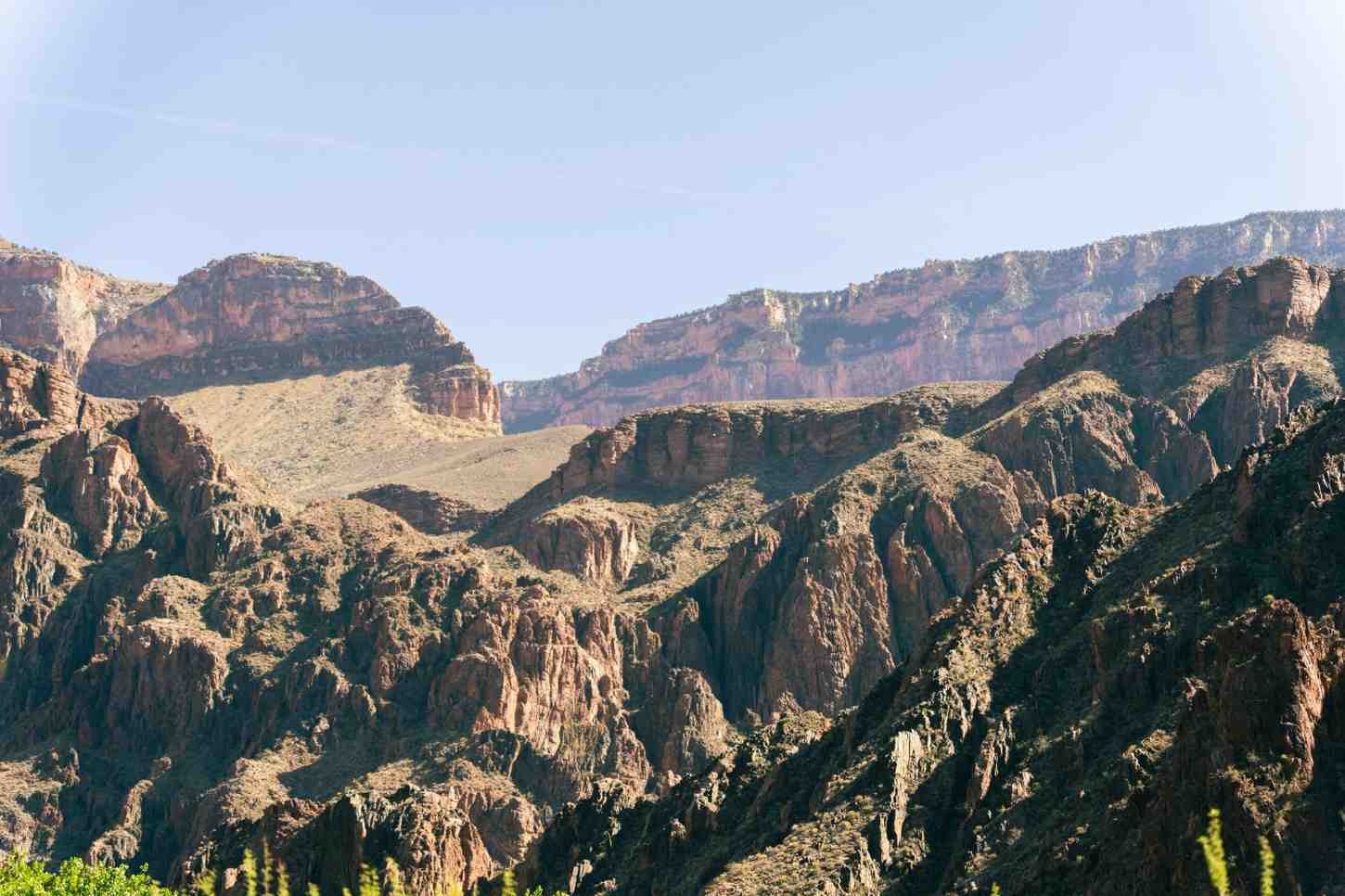
The Grand Canyon is 277 miles long, up to 18 miles wide, and over a mile deep. Those numbers make intellectual sense but communicate nothing about the actual experience of standing on the rim for the first time. The brain spends several minutes refusing to believe the scale of what it’s looking at.
The Grand Canyon South Rim is one of the best places to visit near Las Vegas, and the one most likely to reframe everything else you thought qualified as dramatic scenery.
The South Rim is the accessible version: paved roads, a shuttle system, developed visitor infrastructure, and the most iconic viewpoints including Mather Point, Yavapai Point, and Desert View. It sits 280 miles southeast of Las Vegas, a 4.5-hour drive through the Mojave and across the Kaibab Plateau, which makes it the longest day trip on this list and the one that most rewards an overnight stay.
The canyon was carved by the Colorado River over five to six million years, exposing rock layers that stretch back nearly two billion years. The Havasupai, Hualapai, Navajo, and Hopi peoples have lived in and around the canyon for thousands of years, and their presence and cultural connections to the land remain active.
The South Rim operates year-round. Summer is the busiest season, drawing 6 million visitors per year, but the scale of the place means that even at peak crowds, you can walk 20 minutes from any viewpoint and find relative solitude.
Top Things to Do
1. Watch Sunrise at Mather Point: The most accessible viewpoint on the South Rim, a 10-minute walk from the main visitor center. Sunrise is the best time; the light starts at the North Rim opposite and sweeps down into the canyon floor over about 45 minutes, illuminating the rock layers in sequence. In summer, arrive well before dawn and bring layers. The canyon at 6 AM is 10°C colder than at noon.
2. Walk the Rim Trail: A paved, mostly flat 21-km trail runs from Hermit’s Rest in the west to Desert View in the east along the South Rim. The western section, between Mather Point and Hermit’s Rest, is served by the free Hermit Road shuttle from March through November. Walk as much or as little as you want; every half mile brings a new angle on the canyon.
3. Hike Bright Angel Trail: The main maintained trail into the canyon descends 1,375 meters to the Colorado River over 16.5 km. For most visitors, the hike to the 1.5-mile resthouse (a 2 to 3 hour round trip) or the 3-mile resthouse (4 to 5 hours) gives a genuine sense of the canyon’s interior without the risk of the full descent. Do not hike to the river and back in a single day in summer; the heat in the inner gorge regularly exceeds 40°C by midday.
4. Drive Desert View: Desert View, 25 miles east of the main visitor area, has the most unobstructed panoramic view of the canyon on the South Rim. The Desert View Watchtower, designed by Mary Colter in 1932, provides a 360-degree view from its upper deck and contains original Hopi murals inside. Far fewer visitors reach this end of the rim, and the sunset views from Desert View are often better than those at Mather Point.
5. Ranger Programs: The National Park Service runs free ranger-led programs daily at the South Rim, including geology talks, condor spotting walks, and evening campfire programs at Mather Amphitheater. These are consistently excellent and change the way you see the canyon. Check the current schedule at the visitor center or the NPS app.
Don’t Leave Without…
A meal at the El Tovar Dining Room, a 1905 National Historic Landmark with canyon views from the dining room windows, serving buffalo short rib and trout. Make a reservation months in advance. It’s the only full-service restaurant directly on the rim.
RV Practical Info
- Campsite: Mather Campground near the main visitor center has 327 sites, many accommodating RVs up to 30 feet. Reservations are required March through November via recreation.gov; book 6 months ahead for summer.
- Vehicle restrictions: Personal vehicles are not allowed on Hermit Road from March through November. Use the free shuttle. All other rim roads are open to RVs.
- Timed entry: Required for the park entrance May through October. Purchase the timed-entry permit in advance at recreation.gov; arriving without one results in being turned away.
- Distance from Las Vegas: 280 miles (4.5 hours) via US-93 and I-40, or via Hoover Dam and Williams.
- Scenic approach: Come via US-89 through the Navajo Nation for the most scenic route; the road descends to the canyon through the Marble Platform with long views before the rim appears.
Who Is It Best For?
- First-time visitors to the American Southwest; this is a non-negotiable stop
- Families who want a single iconic destination reachable from Las Vegas
- Hikers who want to descend into a canyon carved over millions of years
- Photography-focused travelers who want the defining landscape of the American West
Recommended Budget
- Park entry: $35 per vehicle (7 days); America the Beautiful Pass is highly recommended
- Campsite: $18 to $30 per night at Mather Campground
- Meals: El Tovar from $35 per main course; Bright Angel Restaurant from $15
- Daily estimate: $50 to $100 per person. Timed-entry permits and campsite reservations are included with park entry but must be booked well in advance.
6. Hoover Dam and Lake Mead, Nevada/Arizona
The Vibe
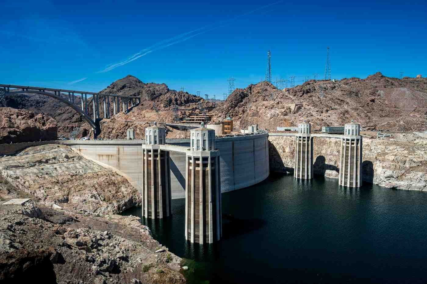
Built between 1931 and 1936 at the height of the Great Depression, Hoover Dam is one of the defining infrastructure projects of 20th-century America: a 221-meter curved concrete arch-gravity dam that holds back the Colorado River, creating Lake Mead, the largest reservoir in the United States by volume. At its completion, it was the tallest dam in the world.
The scale is impressive in person in a way that photographs understate. Standing on the visitor walkway on the dam’s crest, with the reservoir stretching northeast behind you and the river gorge dropping away to the south, gives a genuine sense of what it meant to stop one of North America’s great rivers with concrete and human labor.
The dam was built by six companies over four years, employing over 21,000 workers at its peak. At least 96 industrial deaths occurred during construction. The bronze sculptures at the dam’s crest, the Winged Figures of the Republic by Oskar Hansen, commemorate those workers.
Lake Mead’s water levels have dropped significantly in recent years due to prolonged drought in the Colorado River Basin; the “bathtub ring” of white mineral deposits on the canyon walls marks the former high-water line clearly. This is one of the most visible physical consequences of water scarcity in the American West, and it gives the site a layer of contemporary relevance beyond the engineering story.
Top Things to Do
1. The Hoover Dam Powerplant Tour: The standard tour takes you inside the dam, through the tunnels cut through the canyon wall, into the powerhouse where the 17 generators produce 2,080 megawatts of electricity, and onto the dam’s crest for open views. Allow 1.5 to 2 hours. Standard tickets cost around $15; the Powerplant Tour costs around $30.
2. Walk the Mike O’Callaghan–Pat Tillman Memorial Bridge: The pedestrian walkway on the bridge 275 meters downstream from the dam offers the best aerial view of the dam and the river gorge. The view directly down to the Colorado River is vertiginous. This bridge opened in 2010 specifically to allow foot traffic; it’s free and takes 10 minutes to cross.
3. Drive Through Boulder City: The town built to house Hoover Dam workers is a well-preserved New Deal-era company town: wide streets, art deco municipal buildings, and a genuine small-town character distinct from anything in Las Vegas. The Boulder City/Hoover Dam Museum downtown is small but well-done.
4. Lake Mead Water Activities: Lake Mead National Recreation Area, which surrounds the reservoir, has marinas at Boulder Beach and Callville Bay. Kayak and paddleboard rentals are available. The lake’s warm summer temperatures make it one of the most popular swimming destinations near Las Vegas, though current water levels mean some boat launches may be limited.
Don’t Leave Without…
Arriving at the dam around 7 AM before the tour buses, and seeing the winged bronze figures catch the early desert light while the canyon below is still in shadow. The dam was built to last 2,000 years; in the morning quiet, that timeline feels credible.
RV Practical Info
- Parking: Commercial vehicles and RVs are directed to the Arizona side parking garage on the US-93 approach. The garage can accommodate most standard RV sizes; call ahead for larger rigs.
- Distance from Las Vegas: 30 miles southeast via US-93. Allow 45 minutes including weekend traffic.
- Combined route: Pair with Valley of Fire to the northeast for a full day. Leave the dam by noon, drive through Boulder City, and cross Lake Mead via SR-167 to the park.
- Fuel: Fill up in Boulder City before crossing into Arizona; fuel is cheaper on the Nevada side.
Who Is It Best For?
- History and engineering enthusiasts
- Families with curious kids who respond to “how did they build this?” type experiences
- Road trippers driving toward the Grand Canyon via US-93 and US-40
Recommended Budget
- Dam tour: $15 to $30 per person depending on tour level
- Bridge walkway: Free
- Lake Mead entry: $25 per vehicle (7 days)
- Daily estimate: $20 to $50 per person for a half-day visit
7. Zion National Park, Utah
The Vibe
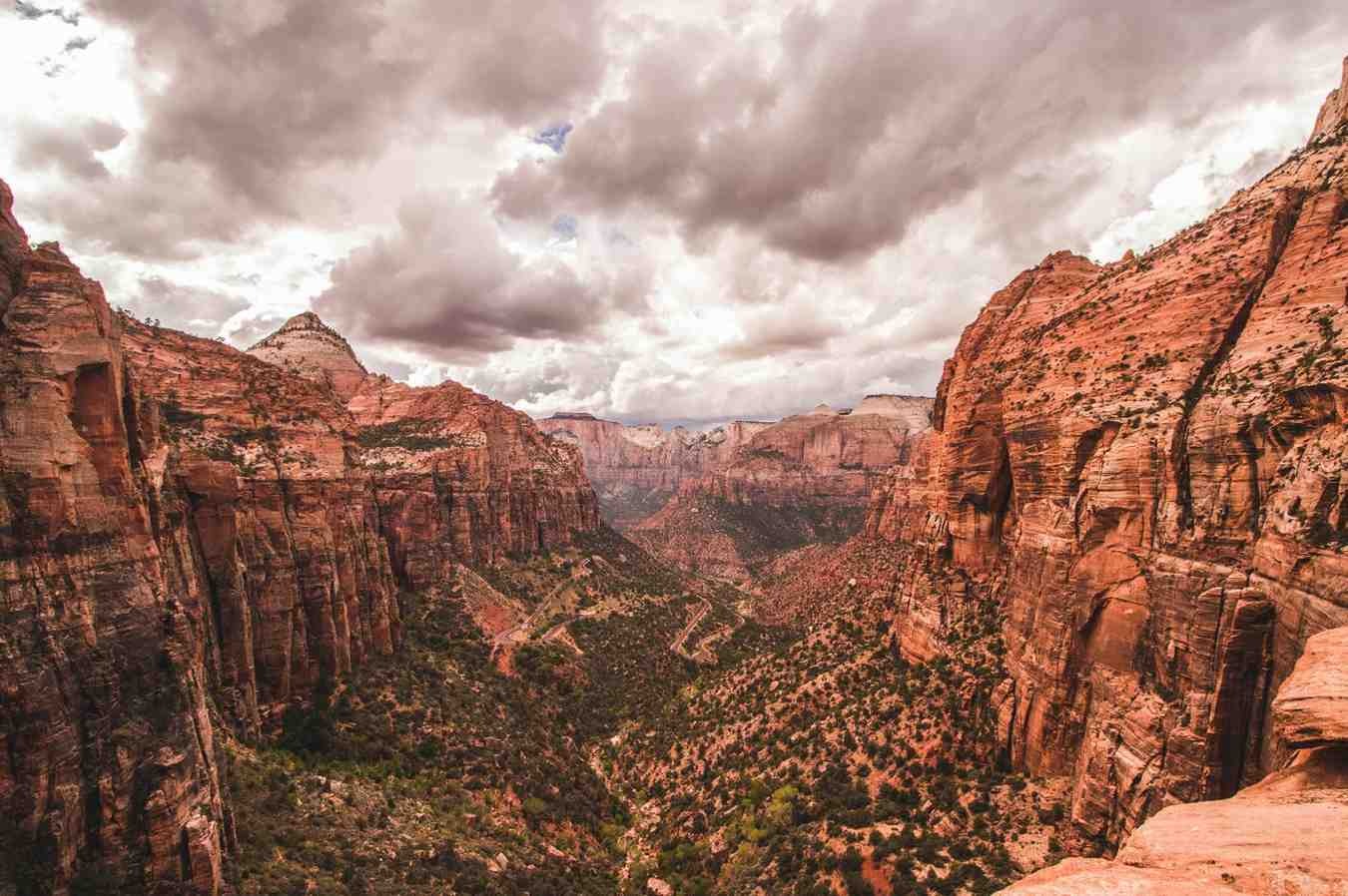
Zion is a canyon that works differently from the Grand Canyon. Where the Grand Canyon asks you to look down and out, Zion asks you to look straight up. The canyon walls here, Navajo sandstone formed from ancient dunes 270 million years old and colored in bands of cream, pink, orange, and red, rise 600 to 900 meters directly above the canyon floor where the Virgin River runs.
The Zion Canyon is 25 miles long and was carved by the Virgin River over two million years. The Anasazi and Fremont peoples lived here for centuries; the first Mormon settlers arrived in 1858 and named the place after the Hebrew concept of sanctuary.
The park draws over four million visitors per year, and the main canyon shuttle system was introduced because the canyon road cannot handle the vehicle load from spring through fall. The shuttle runs frequently and stops at every trailhead, so it’s a manageable constraint rather than a frustration.
What makes Zion different from anything else near Las Vegas is the intimacy of the landscape. In the Grand Canyon you observe from above; in Zion, you are inside the canyon at the bottom, looking up at walls that block out the sky. The light at midday turns the canyon into a slot of blue above your head. It feels contained despite the raw scale.
Top Things to Do
1. Hike Angels Landing: The most famous hike in Zion, a 4.4-mile round trip trail that climbs 454 meters to a narrow sandstone ridge above the canyon, with sheer 400-meter drop-offs on both sides. The final half mile involves chain-assisted scrambling along a ridge less than a meter wide. A permit is required for the chains section via the recreation.gov lottery; apply months in advance. The views across the canyon from the top are among the finest in the American Southwest.
2. Walk The Narrows: The Virgin River disappears into a slot canyon at the top of Zion Canyon, where the walls are 18 to 30 meters apart and over 300 meters tall. The hike is done in the river itself; waterproof boots or rental canyoneering shoes are essential. The full upstream route (16 miles from the top) requires a permit, but the bottom-up walk from the Temple of Sinawava shuttle stop requires none. Go as far as you want and turn around.
3. Emerald Pools Trail: A 2.7-mile roundtrip trail through hanging gardens and past three tiered pools fed by seeping sandstone. This is a good option for families and those who want Zion’s scenery without the permit process or physical commitment of Angels Landing.
4. Canyon Overlook Trail: A 1-mile, 35-minute hike from a trailhead near the tunnel entrance that gives one of the park’s best panoramic views with minimal elevation gain. Often overlooked because it’s right by the road. Best at sunrise before the shuttle crowds arrive.
5. Drive Zion–Mount Carmel Highway: The road from the park’s east entrance through the Zion–Mount Carmel Tunnel (1.1 miles long, built in 1930) and out to the slickrock country of the east side. RVs and larger vehicles require an escort fee to navigate the single-lane tunnel; book at the entrance station. The Checkerboard Mesa viewpoint on the east side is worth stopping for.
Don’t Leave Without…
A breakfast burrito from Zion Canyon Brew Pub in Springdale before the 8 AM shuttle, eaten on the patio with the canyon walls behind you. Then walk to the first shuttle stop before the line builds.
RV Practical Info
- Canyon shuttle: Personal vehicles are not permitted in Zion Canyon from early March through late November. Park at the visitor center or in Springdale and take the free park shuttle.
- RV tunnel fee: RVs over 11 feet 4 inches wide or over 13 feet 1 inch tall require an escort through the Zion–Mount Carmel Tunnel. The fee is $15, paid at the entrance station.
- Campsite: South Campground and Watchman Campground both accommodate RVs. Reservations are essential from March through October via recreation.gov; book 5 to 6 months in advance for summer.
- Distance from Las Vegas: 160 miles northeast via I-15. Allow 2.5 to 3 hours.
- Scenic return: Come back from Zion via US-89 south through Kanab for a different landscape; the Vermilion Cliffs are visible from the highway and require no detour.
Who Is It Best For?
- Hikers of all levels; the range from Canyon Overlook (easy) to Angels Landing (strenuous, permit required) covers every ability
- Families who want a structured, scenic park with a reliable shuttle system
- Road trippers combining Zion with Bryce Canyon or the Grand Canyon North Rim
- Anyone who wants the defining red-rock canyon experience of the American Southwest
Recommended Budget
- Park entry: $35 per vehicle (7 days); America the Beautiful Pass applies
- Campsite: $20 to $30 per night at South or Watchman campgrounds
- Meals: Springdale has good independent restaurants; expect $15 to $30 for a sit-down meal
- Gear rental: Canyoneering shoes for The Narrows around $25 per day
- Daily estimate: $50 to $90 per person
8. Bryce Canyon National Park, Utah
The Vibe
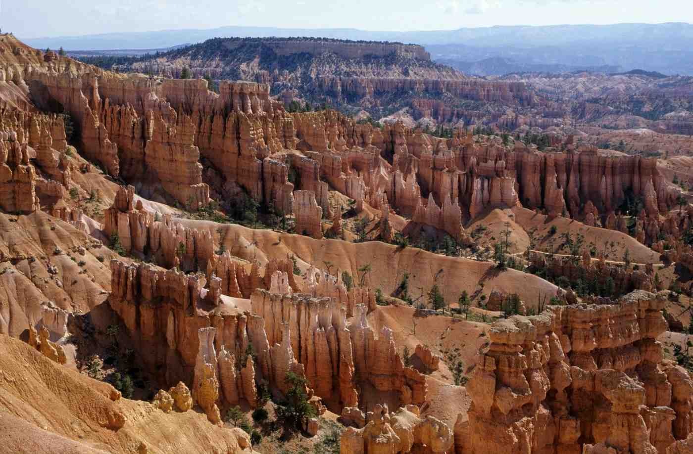
Bryce Canyon is not technically a canyon. It is an amphitheater, carved into the edge of the Paunsaugunt Plateau by frost and rain over millions of years, producing forests of orange and red limestone spires called hoodoos. There are more hoodoos here than anywhere else on earth, and the concentration of them in the main amphitheater is one of the most visually striking landscapes in the American West.
The park sits at 2,400 to 2,700 meters elevation, making it noticeably cooler than Las Vegas and the lower canyon country. In spring and early summer, snow can still cap the hoodoos while the valley floor bakes in desert heat. That elevation also makes Bryce one of the best stargazing locations in the continental United States; the International Dark-Sky Association has designated it a Gold Tier site.
The Milky Way is visible above the hoodoos on clear nights with a clarity that is difficult to find elsewhere in the Southwest. Bryce is a natural extension of a Zion road trip, sitting 90 minutes northeast, and together the two parks give you the full range of Utah’s canyon country in a single circuit without backtracking.
Top Things to Do
1. Watch Sunrise from Sunrise Point (or Bryce Point): The hoodoos catch the first light of day in deep orange and amber before shifting to pink and white as the sun climbs. Sunrise Point, on the northern rim, is the most accessible viewpoint. Bryce Point, two miles south, gives a wider amphitheater view and fewer people at dawn. Arrive 20 minutes before sunrise and position yourself on the rim edge.
2. Hike the Navajo Loop and Queens Garden Trail: The 5.5-km combination of these two trails descends from the rim into the heart of the hoodoo forest and is the best way to understand the scale of the formations from below. The Navajo Loop drops steeply through Wall Street, a narrow slot between two hoodoos over 20 meters tall. Queens Garden is gentler and winds past formations named for their resemblance to Victorian garden statuary. Start at Sunset Point and finish at Sunrise Point.
3. Stargaze from the Rim: The Bryce Canyon Astronomy Festival, held in late June, draws astronomers and telescope clubs from across the country. Outside of festival dates, the park’s amphitheater viewpoints are accessible after dark, and the elevation means the air is thin and clear. The hoodoos in full moonlight look completely different from their daylight appearance; worth a late-night walk along the rim trail.
4. Hike the Peek-A-Boo Loop: A 5.5-km loop through the southern section of the main amphitheater, accessed via a steep descent from Bryce Point. The loop passes through the Wall of Windows and the Cathedral, two of the most dramatic hoodoo formations in the park. This trail sees fewer visitors than the Navajo Loop and rewards the extra effort with near-solitude among the spires.
5. Drive the Scenic Byway to Rainbow Point: Utah Scenic Byway 63 runs 29 km from the park entrance to Rainbow Point at the southern end, the highest point in the park at 2,775 meters. The road passes 13 viewpoints, each slightly higher and with slightly wider views than the last. Allow two hours to drive it properly with stops.
Don’t Leave Without…
Peeling a small strip of bark from a mature ponderosa pine on the rim trail and smelling it. The bark smells unmistakably of vanilla and butterscotch, a characteristic of mature ponderosa pines produced by the same compounds used in artificial vanilla flavoring. It’s a detail that almost nobody notices until someone points it out, and after that you smell it on every ponderosa in the park.
RV Practical Info
- Campsite: North Campground and Sunset Campground both accommodate RVs. North Campground has sites up to 40 feet; Sunset Campground limits to 20 feet. Both require reservations via recreation.gov from May through October; book 4 to 6 months in advance for summer.
- Propane refill: No propane available inside the park. Fill up in Panguitch (25 miles north) or Tropic (11 miles east) before arriving.
- Shuttle: A free park shuttle runs from Ruby’s Inn outside the park entrance to all major viewpoints from April through October. This avoids significant parking pressure at Sunrise and Sunset Points in peak season.
- Distance from Las Vegas: 270 miles northeast via I-15 and UT-20. Allow 3.5 to 4 hours. From Zion, it’s 90 minutes northeast on UT-9 and US-89.
- Scenic route: Drive back to Las Vegas via US-89 south through Kanab and across the Arizona Strip for the most dramatic return corridor; the Vermilion Cliffs are visible for most of the route.
Who Is It Best For?
- Photographers who want the defining hoodoo landscape of the American West at golden hour
- Stargazers; Bryce’s Gold Tier dark-sky designation makes it one of the best viewing sites in the continental US
- Road trippers combining with Zion for a two-park Utah circuit from Las Vegas
- Couples and solo travelers who want a quieter park experience than the Grand Canyon or Zion
Recommended Budget
- Park entry: $35 per vehicle (7 days); America the Beautiful Pass applies
- Campsite: $20 to $30 per night at North or Sunset Campground
- Meals: No restaurants inside the park. Ruby’s Inn outside the entrance has a general store and diner; Panguitch has basic options. Budget $15 to $25 if eating out, or cook in the RV.
- Daily estimate: $30 to $65 per person
9. Death Valley National Park, California
The Vibe
Death Valley is the hottest, driest, and lowest national park in the United States. Badwater Basin, at 86 meters below sea level, is the lowest point in North America. The record air temperature here, 56.7°C recorded in 1913, remains the highest reliably documented surface temperature on earth. In summer, the ground surface exceeds 80°C.
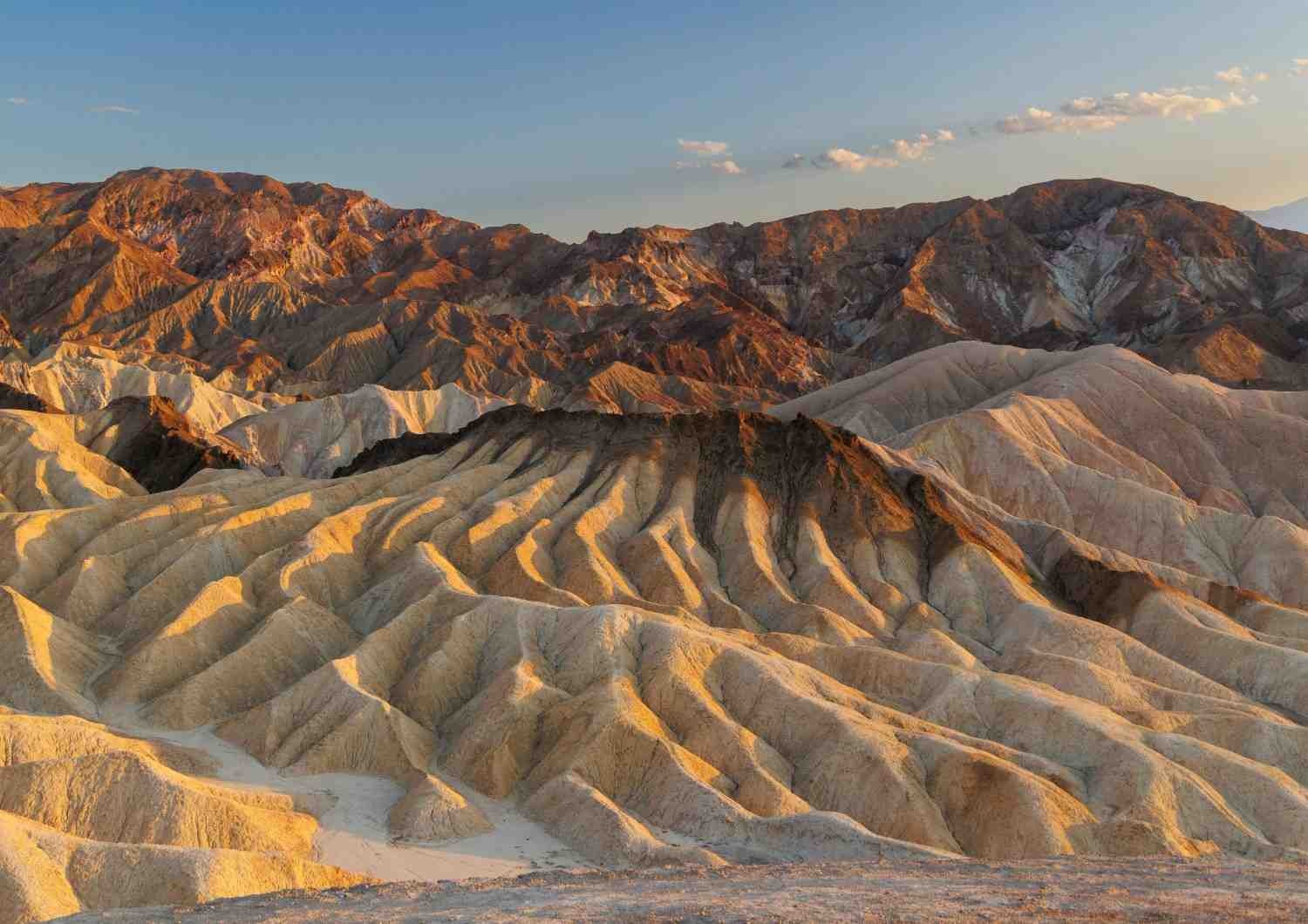
None of this is a deterrent if you go at the right time. From October through April, Death Valley is one of the most extraordinary landscapes on the continent; vast salt flats that reflect the sky like a mirror, sand dunes that glow amber in the late afternoon, volcanic craters, and canyon walls striped in twenty shades of mineral color. The Mesquite Flat Sand Dunes catch the first and last light of day in a way that makes the desert floor look liquid.
Death Valley is 140 miles west of Las Vegas, making it the closest major national park to the city. The drive west on US-95 and into the park through Beatty takes about two hours. The park is enormous at 5,270 square miles, larger than Connecticut, and most visitors see only a fraction of it.
The Timbisha Shoshone people have lived in the valley for over a thousand years, maintaining a permanent village at Furnace Creek that survives today.
Top Things to Do
1. Walk Badwater Basin at Dawn: The salt flat at Badwater extends 8 km into the valley floor, a white expanse of crystallized sodium chloride formed as ancient Lake Manly evaporated. At dawn, before the heat builds, the walk across the flat toward the center of the basin gives an unobstructed 360-degree view of the surrounding mountains with no other features to interrupt it. The boardwalk from the parking area reaches the salt flat in five minutes.
2. Watch Sunrise from Zabriskie Point: The eroded badlands formation above the valley floor turns gold, pink, and purple in the minutes before and after sunrise. The viewpoint is a 10-minute walk from the parking area. In spring, when the salt flats below reflect the dawn sky, the view from Zabriskie Point is among the best in the park.
3. Walk the Mesquite Flat Sand Dunes: The most accessible dune field in the park, rising up to 30 meters from the valley floor near Stovepipe Wells. There are no marked trails; walk as far into the dunes as you want. Morning and late afternoon light produce the deepest shadows and the most dramatic textures in the sand, and sunrise here is one of the most photographed moments in the Mojave Desert.
4. Drive Artist’s Drive: A 14-km one-way loop through a landscape of multicolored volcanic rock, oxidized in shades of green, pink, purple, and yellow by different mineral compounds. Artist’s Palette, the most saturated section, is best seen in the late afternoon when the low light intensifies the colors. The road is narrow and not recommended for vehicles over 25 feet.
5. Visit Dante’s View: A 1,669-meter ridgeline viewpoint on the east side of the valley, reachable by a paved road from the main valley floor. The view takes in Badwater Basin directly below, the Panamint Range to the west, and on clear days extends to Mount Whitney, the highest point in the contiguous United States. Best visited in the morning before haze builds.
Don’t Leave Without…
Stopping at the Furnace Creek date farm stand and eating a date shake. The Oasis at Death Valley has cultivated date palms since the 1920s; the dates are harvested in the fall and the shakes, made with real fruit and vanilla ice cream, are available year-round. It’s the most unexpected refreshment stop in any national park.
RV Practical Info
- Campsite: Furnace Creek Campground (695 sites, some with hookups) is the most accessible and accommodates all RV sizes. Hookup sites require reservations via recreation.gov October through April. Stovepipe Wells Campground is a cheaper no-hookup alternative. Wild camping is permitted in undeveloped backcountry areas at least 200 feet from paved roads and water sources; check the park website for current restrictions.
- Fuel: Fuel is available at Furnace Creek and Stovepipe Wells but costs significantly more than outside the park. Fill up in Pahrump or Beatty on the Nevada side before entering.
- Heat advisory: From May through September, the NPS advises against any outdoor activity between 10 AM and 4 PM. Death Valley’s heat is not comparable to other desert parks; heat-related fatalities occur here annually among unprepared visitors. October through April is the practical window for most activities.
- Distance from Las Vegas: 140 miles west via US-95 and NV-267 through Beatty. Allow 2 to 2.5 hours.
- Scenic route: Return to Las Vegas via CA-190 east over the Amargosa Range and down through Pahrump for a different approach than the entry route.
Who Is It Best For?
- Photographers chasing extreme landscapes: salt flats, dunes, and mineral-colored badlands
- Nature enthusiasts who want the least-visited national park accessible from Las Vegas
- Road trippers who want to add a California destination to a Nevada-Utah itinerary
- Visitors traveling October through April, when the heat is manageable and the desert is at its most photogenic
Recommended Budget
- Park entry: $35 per vehicle (7 days); America the Beautiful Pass applies
- Campsite: $16 to $36 per night depending on campground and hookup availability
- Fuel: Budget extra; fuel inside the park runs $0.50 to $1.00 more per gallon than Pahrump or Beatty
- Daily estimate: $35 to $75 per person
10. Sedona, Arizona
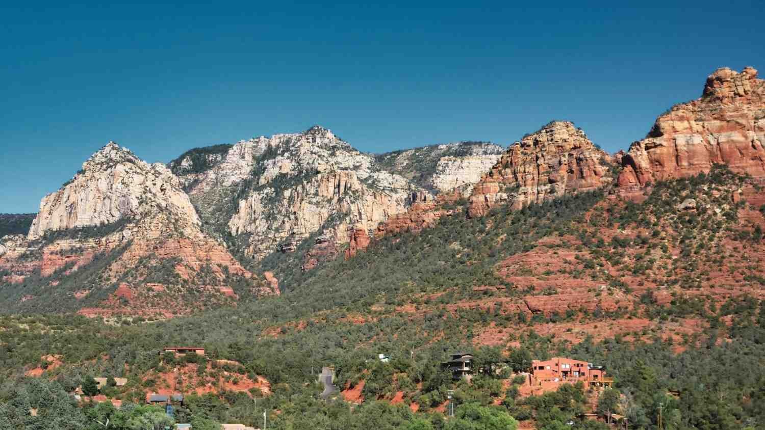
The Vibe
Sedona sits in a red rock basin in northern Arizona, surrounded by sandstone buttes and mesas that rise 300 to 500 meters above the high desert floor. The formations, named Cathedral Rock, Bell Rock, Coffeepot, and Courthouse Butte among others, turn deep crimson at sunrise and sunset in a light show that happens twice a day without any special conditions required.
The town itself is an unusual combination: a genuine arts community with 80-plus galleries, a wellness industry built around the area’s reputation for spiritual energy vortexes, and some of the best day-hiking terrain in Arizona. The culinary scene is more developed than any other destination in this guide outside of Las Vegas itself.
Sedona is 280 miles southeast of Las Vegas, a 4-hour drive via US-93 and I-40, making it the furthest destination in this guide. It works best as a two or three-night stop rather than a day trip, and pairs naturally with the Grand Canyon South Rim, 130 miles north, on a southbound return loop to Vegas.
The Oak Creek Canyon, the gorge running north from Sedona toward Flagstaff on AZ-89A, is one of the best scenic drives in Arizona and often overlooked by visitors who approach from the south.
Top Things to Do
1. Hike Cathedral Rock Trail: The most photographed formation in Sedona, Cathedral Rock is a 1.5-mile round trip scramble up slickrock to a saddle between the two main spires, with panoramic views over the red rock basin and Oak Creek below. The trail gains 220 meters in 0.75 miles; trekking poles and appropriate footwear are recommended. The trailhead parking fills by 7 AM on weekends; arrive early or use the Red Rock Pass shuttle from the Tlaquepaque parking area.
2. Sunrise at Bell Rock: Bell Rock is a 430-meter butte accessible via a short 1.5-mile loop trail from the Bell Rock Trailhead on SR-179. The formation is climbable to various levels depending on comfort with exposure; no technical equipment is required for the lower sections. At sunrise, Bell Rock turns orange in a light that lasts about 20 minutes before the color flattens.
3. Drive Oak Creek Canyon: AZ-89A north from Sedona climbs through the Oak Creek Canyon, a narrow gorge with 300-meter red sandstone walls above a perennial creek lined with cottonwood and sycamore trees. The 24-km drive from Sedona to Flagstaff passes Slide Rock State Park (a natural sandstone waterslide in the creek, popular in summer) and several swimming holes. The canyon road is one-lane in sections and not recommended for RVs over 28 feet.
4. Explore Tlaquepaque Arts Village: A collection of galleries, studios, and restaurants in a recreated Mexican hacienda setting on the banks of Oak Creek. The architecture is deliberate and the commercial aspect is obvious, but the gallery quality is genuine; several nationally recognized artists show here. The Thursday evening gallery walk runs year-round.
5. Take a Jeep Tour to the Backcountry: The backcountry roads around Sedona access formations and viewpoints unreachable by standard vehicles: Broken Arrow, Soldier Pass, and the Schnebly Hill Road corridor. Pink Jeep Tours and several other operators run half-day and full-day tours. The Schnebly Hill Road, if your RV can handle the first section of unpaved track, provides the most elevated views of the red rock basin.
Don’t Leave Without…
Eating dinner at Elote Café, a small restaurant in Sedona that has been consistently ranked among the best Mexican restaurants in Arizona for over a decade. The elote (street corn) appetizer and slow-roasted pork shoulder are the things to order. Reservations are required and they fill several weeks ahead; book before you leave Las Vegas.
RV Practical Info
- Red Rock Pass: Required for parking at all National Forest trailheads in the Sedona area. Day pass $5; week pass $15. Available at trailhead kiosks or online at recreation.gov. The America the Beautiful Pass does not cover Red Rock Pass.
- Campsite: Manzanita Campground in Oak Creek Canyon (18 sites, first-come-first-served, no hookups, no reservations) is the most scenic option but fills by midday in peak season. Cave Springs Campground further north in the canyon takes reservations and has more capacity. Rancho Sedona RV Park in the town itself has full hookups and accepts larger rigs.
- RV size: Oak Creek Canyon road is not suitable for rigs over 28 feet. The main Sedona basin roads handle all standard RV sizes.
- Distance from Las Vegas: 280 miles southeast via US-93 and I-40 through Kingman. Allow 4 hours. From the Grand Canyon South Rim, Sedona is 130 miles south on AZ-180 and SR-89A, a 2.5-hour drive through Flagstaff.
- Scenic route: Return to Las Vegas from Sedona via I-40 west through Williams, then north on AZ-93 through Kingman for a direct return, or extend via the Grand Canyon on the way back for a full loop.
Who Is It Best For?
- Couples looking for the best combination of hiking, dining, and scenery in the Southwest
- Photographers who want red rock landscapes at golden hour with reliable access and no permit lottery
- Road trippers building a loop through Arizona that includes the Grand Canyon South Rim
- Hikers who want technically accessible but visually dramatic trails without the crowds of Zion in peak season
Recommended Budget
- Red Rock Pass: $5 to $15 depending on duration
- Campsite: $25 to $45 per night for full hookups at Rancho Sedona; $15 to $22 at Oak Creek Canyon campgrounds (no hookups)
- Meals: Sedona’s restaurant scene is the strongest of any non-city destination in this guide; expect $20 to $45 for a sit-down dinner
- Jeep tours: $80 to $150 per person for a half-day guided backcountry tour
- Daily estimate: $60 to $130 per person, the highest of any park destination in this guide
What to Pack for a Las Vegas Road Trip
| Category | Items | Why You Need It |
| Clothing | Lightweight moisture-wicking layers, one warm fleece, wide-brim hat, UV-rated long sleeves, comfortable walking shoes, sandals for the Strip | Desert temperature swings are extreme; 40°C by noon and 18°C at canyon elevation before sunrise |
| Sun and heat | SPF 50+ sunscreen, UV-blocking sunglasses, electrolyte tablets or powder, insulated water bottles (minimum 2L per person) | UV intensity in the Mojave is severe year-round; dehydration is the leading cause of emergency rescue in Southwest parks |
| RV Essentials | Leveling blocks, full-hookup adapters, water filtration system for dry camping, dump station map, portable fan to supplement built-in AC | Temperatures inside a non-running RV can exceed 55°C in a Las Vegas parking lot in summer |
| Hiking Gear | Trekking poles for canyon trails, trail running or hiking shoes with ankle support, headlamp for early starts, day pack | Bright Angel and Angels Landing involve significant elevation change; early starts require headlamp navigation to trailheads |
| Tech | Offline maps downloaded (Google Maps, Gaia GPS), portable power bank, US Class A power adapter | Cell coverage in Zion canyon and Valley of Fire is unreliable; power-heavy RV appliances may need shore power |
| Reservation Documents | Timed-entry permits (Grand Canyon, Zion), campsite reservation confirmations, America the Beautiful Pass | Rangers check permits at park entrances; no permit means no entry during reservation windows |
Expert Tips for Las Vegas Travel
1. Buy the America the Beautiful Pass before you leave Las Vegas. At $80 per vehicle for 12 months, it covers the Grand Canyon, Zion, Lake Mead, and Red Rock Canyon, paying for itself after two parks. Buy it at the first park entrance you reach; the ranger will sell it to you on entry.
2. Book timed-entry permits the moment reservation windows open. Grand Canyon timed-entry permits open 90 days in advance. Zion’s Angels Landing permit uses a lottery system that opens months ahead. Both fill within hours. Set a calendar reminder and book on the day the window opens, not when you’re finalizing your itinerary.
3. Schedule all outdoor activity before 10 AM or after 5 PM from May through September. The National Park Service’s standard heat advisory for the Southwest desert is direct: do not hike between 10 AM and 4 PM in summer. This applies to Red Rock, Valley of Fire, and the inner canyon of both Zion and the Grand Canyon. Early starts are a safety measure, not a preference.
4. Carry more water than you think you need. The standard recommendation for desert hiking is one liter per hour of activity per person. In direct summer sun, that’s a minimum. The Narrows in Zion can require 3 to 4 liters for a half-day wade. Fill hydration packs the night before and add electrolyte supplements; water alone isn’t enough in extreme heat.
5. The Strip is cheapest on Tuesday and Wednesday nights. Hotel rates, show tickets, and restaurant reservations all drop mid-week. If your trip allows flexibility, arriving Tuesday and leaving Thursday cuts costs significantly. The casinos are also quieter, which is either a selling point or a deterrent depending on what you’re after.
6. Use the Deuce bus to move between the Strip and Fremont Street. A $6 24-hour pass on the Las Vegas Deuce bus covers the full Strip corridor and runs 24 hours. Parking an RV on the Strip is expensive and inconvenient; leave it at the campsite and take the bus for city days.
7. Check Valley of Fire campsite hookup availability for summer nights. The Atlatl Rock campground’s electric hookup sites let you run air conditioning overnight, which is critical if you’re traveling in summer. Sites fill fast in spring; book as soon as reservation windows open at reserveamerica.com.
8. Combine Zion and Bryce Canyon for a two-park, four-day extension. From Zion, Bryce Canyon is 90 minutes northeast on UT-9 and US-89. Drive to Zion, spend two nights, continue to Bryce for two nights, then return via Kanab and US-89 to Las Vegas without retracing the route. It’s the most efficient way to cover the two best parks in Utah’s canyon country in a single circuit.
Plan Your Las Vegas Trip with Indie Campers
Las Vegas sits at the center of the American Southwest, and with a full tank of gas, you have access to five national parks, two state parks, and a 277-mile canyon. No other city in the United States gives you this range from a single pickup location.
The ten destinations in this guide, most recommending one to three nights each, add up to two weeks of park-based travel without repeating a campsite, and a RV rental in the USA through Indie Campers is the practical way to run that itinerary, you get:
- One-way rentals across 70+ locations: Pick up in Las Vegas, drive through Red Rock Canyon, Zion, and Bryce Canyon, and drop off in Salt Lake City without retracing a single mile. Or loop through Death Valley, Sedona, and the Grand Canyon and drop off in Phoenix. The route is yours to design.
- More than 8,000 campervans, motorhomes, and RVs: Compact vehicles for two people and larger motorhomes for families. Every vehicle on the Indie Campers owned fleet includes unlimited mileage.
- Flexible cancellation, with no upfront commitment: Grand Canyon and Zion permits need to be booked months in advance. With flexible cancellation up to 31 days before pick-up and Book Now, Pay Later (the full balance isn’t due until 30 days before pick-up), you can lock in a vehicle while you finalize permits and reservations, without financial risk if plans shift.
- 24/7 support, including in remote areas: Cell coverage disappears in Valley of Fire, inside Zion canyon, and across much of Death Valley. If something goes wrong on a desert road at midnight, the Indie Campers support team is available around the clock.
- Book and manage everything online: From vehicle selection through to pick-up day, the entire booking process is handled digitally with no back-and-forth required.
Park permits fill months in advance. So does the right vehicle. Book your RV rental in Las Vegas and build the itinerary from there.
Everything You Need to Know: Las Vegas RV Road Trips
| City/Area | State | Vibe | Best For | Top Things to Do | Budget/Day | Top Campgrounds | RV Rating | Wild Camping | Best Stay |
| The Strip | Nevada | Electric | Nightlife, dining | Sphere, Bellagio, Neon Museum | 💰💰💰 | Las Vegas KOA, Las Vegas Motorcoach Resort | ★★★☆☆ | No | Indie Campers |
| Fremont Street | Nevada | Retro | Budget, history | Mob Museum, El Cortez, Light Show | 💰💰 | Las Vegas KOA (15 min drive) | ★★★☆☆ | No | Indie Campers |
| Red Rock Canyon | Nevada | Scenic | Hikers, photographers | Scenic Loop, Calico Tanks, Climbing | 💰 | Red Rock Canyon Campground | ★★★★☆ | No | Indie Campers |
| Valley of Fire | Nevada | Otherworldly | Photographers, nature | Fire Wave, Petroglyphs, White Domes | 💰 | Atlatl Rock (hookups), Arch Rock | ★★★★☆ | No | Indie Campers |
| Grand Canyon South Rim | Arizona | Iconic | First-timers, hikers | Mather Point, Bright Angel, Desert View | 💰💰 | Mather Campground | ★★★★☆ | No | Indie Campers |
| Hoover Dam and Lake Mead | NV/AZ | Historic | History, families | Dam Tour, Bridge Walk, Lake Mead | 💰 | Boulder Beach Campground | ★★★☆☆ | No | Indie Campers |
| Zion NP | Utah | Towering | Hikers, road trippers | Angels Landing, The Narrows, Overlook | 💰💰 | South and Watchman Campgrounds | ★★★★★ | No | Indie Campers |
| Bryce Canyon | Utah | Surreal | Photographers, hikers | Sunrise Point, Navajo Loop, stargazing | 💰💰 | North and Sunset Campgrounds | ★★★★☆ | No | Indie Campers |
| Death Valley | California | Extreme | Photographers, nature | Badwater Basin, Mesquite Dunes, Zabriskie Point | 💰 | Furnace Creek, Stovepipe Wells | ★★★★☆ | Yes (backcountry) | Indie Campers |
| Sedona | Arizona | Red Rock | Couples, hikers | Cathedral Rock, Bell Rock, Oak Creek Canyon | 💰💰💰 | Rancho Sedona RV Park, Cave Springs | ★★★☆☆ | No | Indie Campers |
FAQs About Where to Go in Las Vegas
Where can I rent an RV in Las Vegas in 2026?
You can rent an RV in Las Vegas through Indie Campers, which offers pickup in Las Vegas with vehicles ranging from compact campervans to full-size motorhomes. Bookings can be made entirely online, with flexible cancellation up to 31 days before pick-up and a Book Now, Pay Later option (the full balance isn’t due until 30 days before pick-up).
Las Vegas is one of Indie Campers’ key US pickup locations, with one-way rentals available to cities including Salt Lake City, Phoenix, and Los Angeles, covering the full Southwest circuit in this guide.
What is the warmest area near Las Vegas in 2026?
The Las Vegas Valley itself is the warmest destination in the region, with summer temperatures regularly exceeding 40°C (104°F) between June and September. Death Valley, 140 miles west, is the hottest national park in the US and regularly exceeds 45°C in summer; it is best visited October through April. For warmth without extreme heat, visit in March through May or October through November, when temperatures sit between 20°C and 32°C across most destinations in this guide.
What is the coolest area near Las Vegas in 2026?
Bryce Canyon is the coolest destination in this guide, sitting at 2,400 to 2,700 meters elevation and typically 15 to 20°C cooler than Las Vegas in summer. Zion National Park and the Grand Canyon South Rim are next, at 1,200 to 2,100 meters, and both run 8 to 12°C cooler than the valley floor. Sedona, at around 1,300 meters, offers a middle ground: warm enough for comfortable hiking year-round but noticeably cooler than the desert basin in summer.
What is the best place to visit near Las Vegas for couples?
Sedona is the best multi-day destination for couples: the combination of accessible red rock hiking, a developed restaurant scene, and evening light on the canyon formations creates a pace that works well for two people with different levels of outdoor ambition.
For a closer option, Red Rock Canyon is a strong half-day trip from the Strip, 30 minutes west, with a dramatic desert landscape and easy sunrise access without an overnight commitment.
What is the best place to visit near Las Vegas with family?
The Grand Canyon South Rim is the best family destination accessible from Las Vegas. The free shuttle system, the paved and accessible Rim Trail, the ranger programs, and the absolute scale of the canyon make it engaging for children and adults simultaneously.
Hoover Dam is a strong half-day addition for families with children interested in engineering and history; the powerplant tour is approachable for kids from age 8 and up.
What is the best place to visit near Las Vegas with kids?
The Valley of Fire is the best option for families with younger children: short, rewarding hikes, vivid colors, and visible petroglyphs that make the ancient world tangible.
The Fire Wave trail (1.5 miles) and the Petroglyph Canyon walk are both appropriate for kids ages 5 and up. Bryce Canyon is a strong alternative for slightly older children; the hoodoo formations are visually engaging and the Navajo Loop trail is manageable for kids ages 7 and up.
What is the best place to visit in Las Vegas with friends?
The Strip is the best base for a group trip to Las Vegas; dining, shows, casinos, and the Sphere are all concentrated in a walkable corridor where groups with different interests can split up and reconnect easily.
For outdoor-focused groups, a combined Red Rock Canyon and Valley of Fire day trip is the best single-day option, covering two dramatically different desert landscapes in one circuit. For a multi-day park trip, Zion handles groups well; the shuttle system removes vehicle logistics and Springdale has enough restaurant variety to keep everyone fed.
What are the best places to visit near Las Vegas for first-timers?
The Grand Canyon South Rim and Zion National Park are the two non-negotiable destinations for first-time visitors to the Southwest using Las Vegas as a base. Both have well-developed visitor infrastructure, clear trail systems, and ranger programs that provide context.
The Strip and Fremont Street give you the Las Vegas experience; the canyon parks give you the landscape that makes the region genuinely extraordinary. Bryce Canyon is a strong third stop if time allows; it adds an entirely different geological character to the first two.
What are the best places to visit near Las Vegas for solo travelers?
Red Rock Canyon and the Valley of Fire are the strongest options for solo travelers; both are accessible as day trips, both reward independent exploration, and both are free of the crowd pressure that makes the Strip and major national parks more complicated to navigate alone.
For solo travelers who want a multi-day park experience, Zion is excellent; Springdale has a welcoming small-town atmosphere and the shuttle system makes it easy to move around without a vehicle inside the canyon. Death Valley, visited in cooler months, suits solo travelers who want complete solitude and vast open landscapes.
What are the best places to visit near Las Vegas for nature?
Zion National Park, Death Valley, and Bryce Canyon are the three strongest pure nature destinations accessible from Las Vegas. Zion offers the most intimate canyon experience.
Death Valley offers the most extreme and varied desert geology in North America. Bryce Canyon provides the best stargazing of any park in this guide, alongside its signature hoodoo formations. The Grand Canyon South Rim and Red Rock Canyon round out the list for travelers prioritizing scale and accessible scenery.